Cetopo allows architects to start working immediately, no need to wait for documents, drawings, or surveys. Cetopo provides immediate access to downloadable 2D and 3D files that can be quickly imported into your software. Cetopo’s detailed context models, derived from actual site data, allow you to refine your design before getting survey results. This enables accurate permit applications submitted on time and ensures concepts that are ready for construction without the need for lengthy revisions.
For Architecture
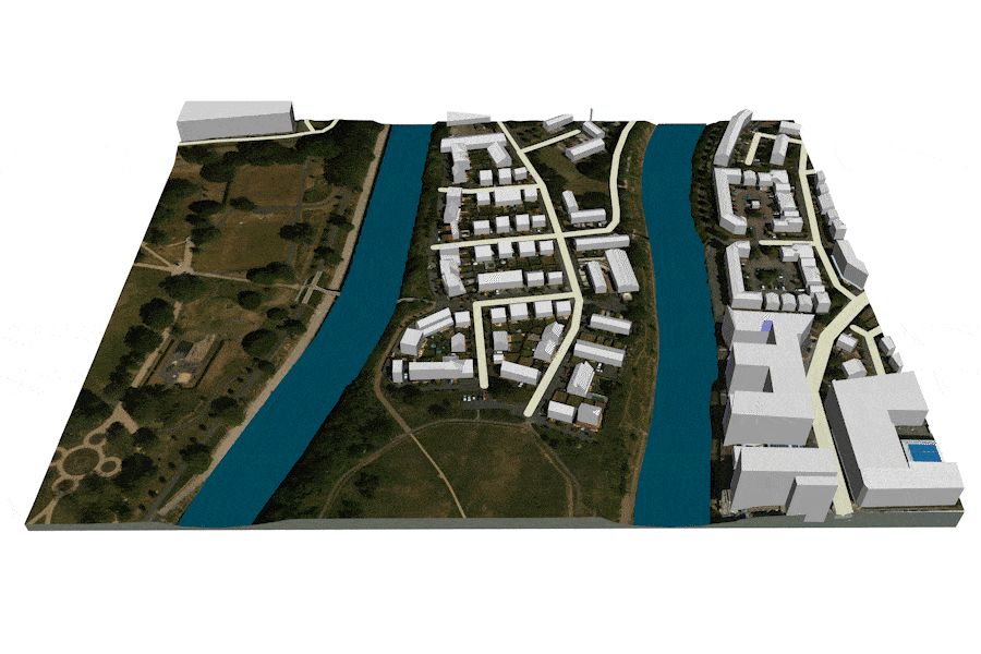
Design great spaces!
Work with confidence with accurate models.

Start working immediately, with instant access

Get all of the data you need, in one place
Cetopo saves time by automating data collection and interpretation, providing architects with comprehensive and up-to-date information about the project site from the start. Cetopo lets users control the information and its presentation format using easily customizable templates that can be saved, shared, and reused. Geographic Information System (GIS) data, topographical information, tree data, and other factors can be easily incorporated into your design workflow as 2D drawings or 3D models, native to software you already use.

Win competitions and projects
Stand out in presentations with convincing and accurate visualizations with no extra time.
Cetopo automates context modeling, creating environments ready for rendering. The efficiency gained through automated site modeling can give architects a competitive edge, as it allows you to produce visually appealing and well-informed submissions without the need for extensive manual work. It saves time, enhances the overall quality of presentations, and allows you to focus on refining the design concept.

Minimize uncertainty in project & budget planning
Using real site data early in the design process minimizes risks in project planning and budgeting by offering a more accurate basis for decision-making. An accurate site model helps plan and estimate costs better by giving a realistic view of the site conditions. This enables better-informed decisions regarding design, construction methods, and resource allocation. Plan and design with confidence and reduce iterations later on at critical stages of the project. Enhance the efficiency and effectiveness of project planning and cost estimation in building projects.
What our users think

Krook & Tjäder
“At Krook & Tjäder we use Cetopo at all stages, from early volume studies to construction documents and in all types of projects, ranging from logistics to hotel- and recreational projects. Without Cetopo it’s very time-consuming to build up terrain and create models, and the material provided can be extremely variable. So, the use of, and demand for Cetopo at our offices is constantly growing. That’s why we think Cetopo is great in every way! “
Emil Andersson
Visualisering, Arkitekterna Krook & Tjäder

Olla Architecture
“Cetopo has completely revolutionized the way we build environment models for our projects. The high quality terrain and vegetation data speeds up the starting phase of a project, while also enabling us to create stunning visualizations quickly.”
Miika Liukka
Architect, Olla Architecture

LINK Arkitektur
“Cetopo’s digital maps have been incredibly valuable in the early stages of our projects. Their platform offers highly accurate information with just a few clicks, and the models they provide greatly assist in creating clear visualizations. This has made our planning and development processes much more efficient.”
Arno De Ryst
Head of Digital, Arkitekt SAR/MSA, LINK Arkitektur

SWECO
“At Sweco, we’ve been using Cetopo since 2022, and it has proven to be a valuable addition to our toolkit for project initiation. The platform’s user-friendliness stands out, allowing us to integrate contextual data into our initial concept development with a few clicks. As a company always seeking ways to enhance our workflow, we appreciate how Cetopo saves us time and refines quality in the planning stages. Prior to using Cetopo, we spent significant time gathering data from various sources. Now our processes are more streamlined, which ultimately makes us more competitive. Cetopo is a one-stop shop for all your context modeling needs.”
Anders Neregård
Studio chief, SWECO Architects
Multi-accuracy models
Cetopo’s multi-accuracy models let you download two models at once. Select your immediate site with high terrain accuracy together with a wider context model covering a large area with compressed terrain data. This lets you work with, analyze and visualize a large area while keeping the context model lightweight.


Selection tools
After using Cetopo’s search function to find your site by property ID or address, you can then use the property selector to pick your specific site. You can adjust your selection using the selection compose tools to offset the property line, make shapes that include your property, and more. You can also use the selection compose tools to add or remove areas from your chosen selection.
2D downloads
Access the 2D information you need across multiple file formats compatible with CAD, BIM, and 3D modeling software, facilitating permit drawings and early concept sketches.

Get more data
Cetopo’s ‘get more data’ feature allows you to seamlessly incorporate Cetopo into your existing workflow. Start your project by importing only the data and features you need. Then select an area in your software, and it will redirect to Cetopo to let you download more information in the same area.